Road Zones and Zone Types
Every road surface in MetaRoad is built from zones. There are two levels:
a Zone Type — a named surface category (Driving, Sidewalk, Tram, Marking, …) defined once for the whole project;
a Road Zone — an instance that assigns a Zone Type to a specific surface (a lane, or a closed-loop fill), with optional per-surface overrides.
Zone Types (project-wide)
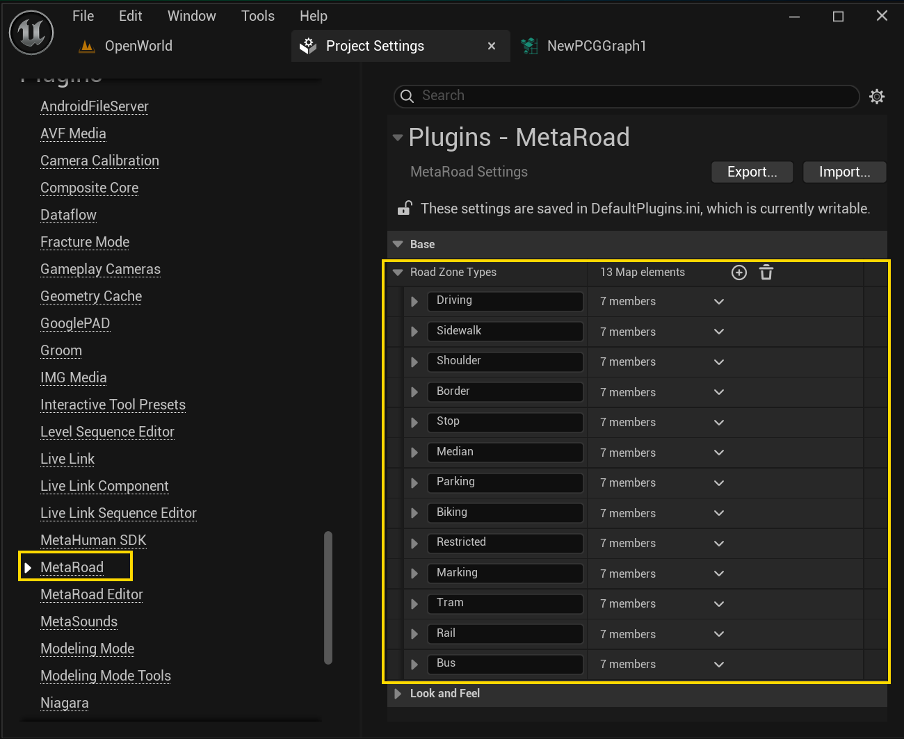
A Zone Type defines what a surface is and how it looks when baked. Zone Types are registered project-wide in
Project Settings → Plugins → Meta Road → Road Zone Types (UMetaRoadSettings::RoadZoneTypes — a map of name →
details).
MetaRoad ships a built-in set — Driving, Sidewalk, Shoulder, Border, Stop, Median, Parking, Biking, Restricted, Marking, Tram, Rail, Bus — and you can add your own.
Each Zone Type stores:
Property |
Meaning |
|---|---|
Mesh Material |
Default material applied to this surface when baking |
Decal Material |
Default decal material — leave empty and no decal is built for this type |
Material Priority |
Where surfaces overlap, the triangle takes the material with the highest priority |
Is Decal |
The zone is a flat overlay projected onto the road surface (adds no height) — for asphalt markings such as arrows and stop lines. (Unrelated to Unreal’s |
Editor Color / Editor Material |
Color and preview material used only in the editor (Schematic view) |
Description |
Free-text note |

Road Zones (per surface)
A Road Zone is a Zone Type in use on a concrete surface. It references a Zone Type and may override that type’s defaults for this one surface:
Property |
Meaning |
|---|---|
Zone Type |
Which Zone Type this surface uses |
Override Material |
Use a custom material instead of the Zone Type’s default |
Override Decal |
Use a custom decal material instead of the default |
Override Priority |
Use a custom material priority instead of the default |
Driving and Sidewalk zones
A Road Zone comes in two kinds, matching the two surface families. Both bake all of their zones into a single mesh (with per-zone material IDs).
Driving (FRoadZoneDriving) — a drivable surface: a normal lane, shoulder, bike, bus, or tram lane. It adds one
option on top of the shared Road Zone fields:
Property |
Meaning |
|---|---|
Invert UV0 |
Flip the U texture coordinate of this lane’s surface |
Sidewalk (FRoadZoneSidewalk) — a pedestrian surface with curb generation. Besides the shared Road Zone fields
it adds:
Property |
Meaning |
|---|---|
Default Height |
Sidewalk height (cm); can be varied along the lane by the Sidewalk Height attribute |
Inside Curb / Outside Curb |
Build the curb on the inner / outer edge of the sidewalk |
Begin Curb / End Curb (+ cap curves) |
Build a cap curb at the start / end of the sidewalk, shaped by a curve |
Curb Profile |
The Curb Profile asset defining the curb’s cross-section |
Override Curb Material |
Use a custom curb material instead of the profile’s default |
Where Road Zones are used
Per lane — every road lane carries a Road Zone, edited in its Selection panel in Section Mode (the Road Zone / Zone Type rows).
Closed-loop fill — a closed spline fills its outline with a Road Zone via
LoopedRoadZone— used for refuge islands, pedestrian crossings, and arrow markings. See Closed Loop Spline.
How the material is resolved
When baking, a surface’s material is chosen in this order:
the Zone Type’s default Mesh Material;
overridden by the Road Zone’s Override Material, if set;
where surfaces overlap, the one with the higher Material Priority wins.
See Baking → Mesh Lane Materials for the baking side.
See also
The Road Model — how lanes (which carry Road Zones) fit into a road.
Closed-Loop Splines — closed-loop fills that use a
LoopedRoadZone.Baking — how zones are baked into meshes and materials.